Using mpi4py for Parallel Computing in Python on Supercomputers
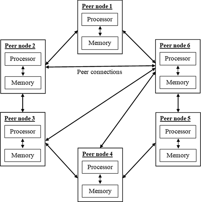
The article discusses the mpi4py module, which is a Python wrapper for MPI, used for parallel computing in ...

Earth Inversion
Practical tutorials, research insights, and reproducible workflows for Earth science problems with modern coding tools.
Seismology, geophysics, and Earth-system investigations with quantitative methods.
Applied Python workflows for scientific computing, statistics, and visual analytics.
Hands-on web development patterns for publishing interactive technical work.
The article discusses the mpi4py module, which is a Python wrapper for MPI, used for parallel computing in ...
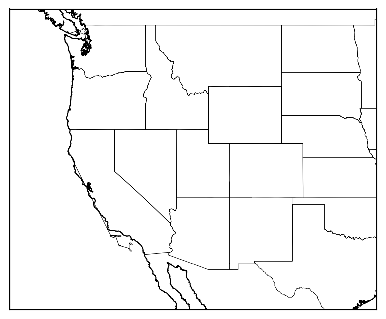
We will plot the boundaries of the states of the USA on a basemap figure
Latest articles on geophysics, scientific computing, numerical methods, and applied data workflows.
You will learn how to generate and set up an SSH key for github so that you don’t need to always type your username and password when accessing github repo.
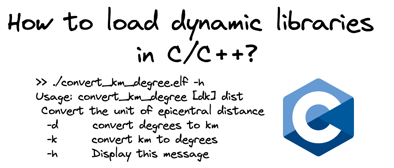
We will see how to load shared libraries in C/C++. We will write a library to convert km to degrees and vice-versa. Then we create a utility program to conve...
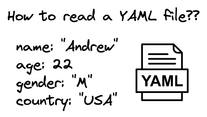
We will see how to read a YAML file in Bash, C/C++ and Python.
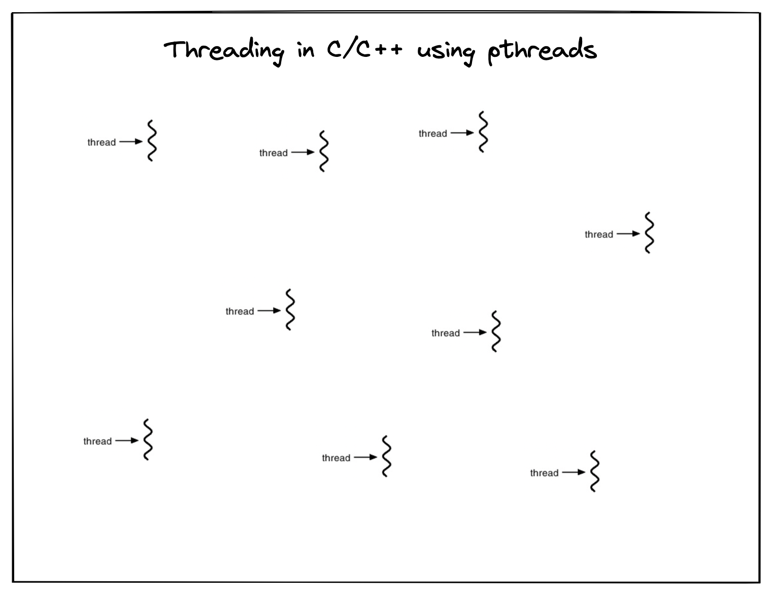
Using multiple threads in C for concurrent process flow
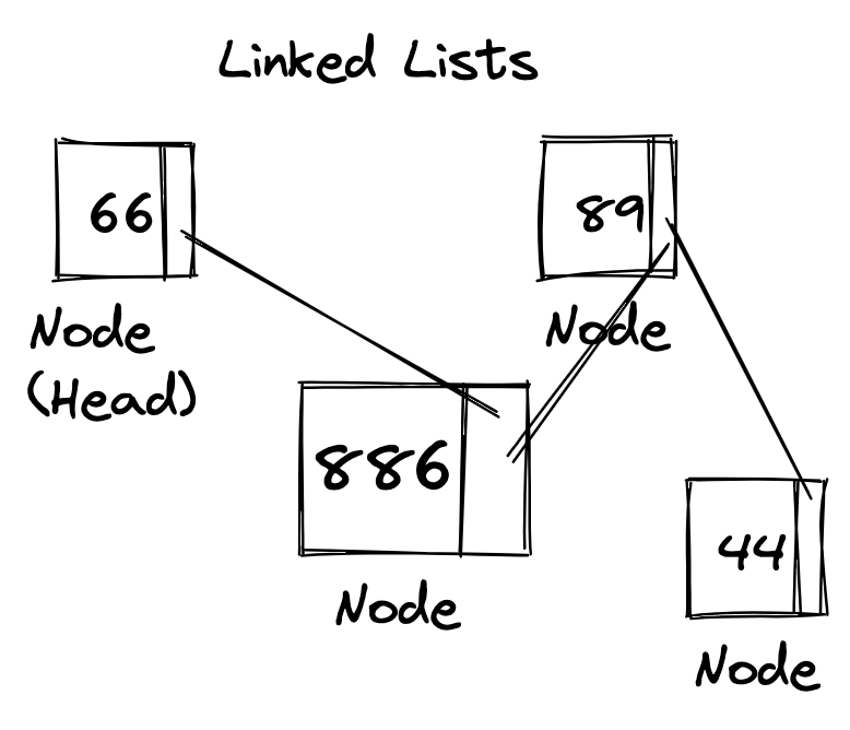
We look into a quick overview of the idea of linked list data structure with some examples.
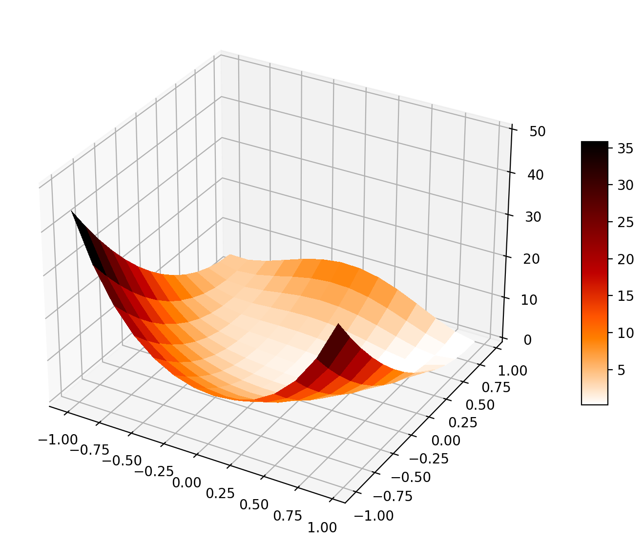
We will inspect the L-BFGS optimization method using one example and compare its performance with the gradient descent method
We will use the Python package to create beamer presentation and append existing figures to each slide
We will see how to plot a topographic map, overlay earthquake data on topographic maps, plot focal mechanism solutions and plot tomographic results on a geog...
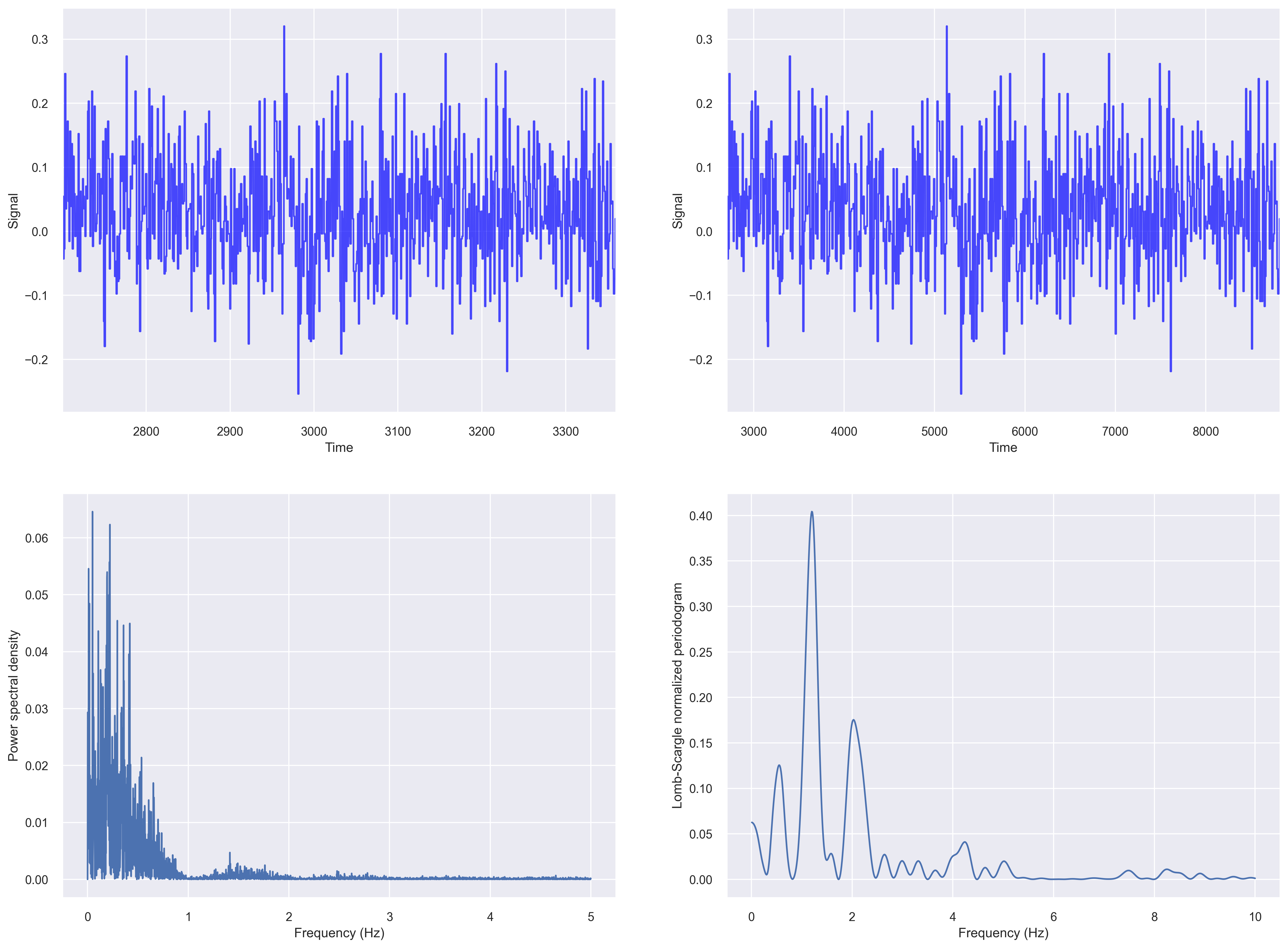
While analyzing time series data, we often come across data that is non-uniformly sampled, i.e., they have non-equidistant time-steps. Infact, most of the re...
We will learn how to use the poetry package to create, manage, build and publish Python package on PyPI
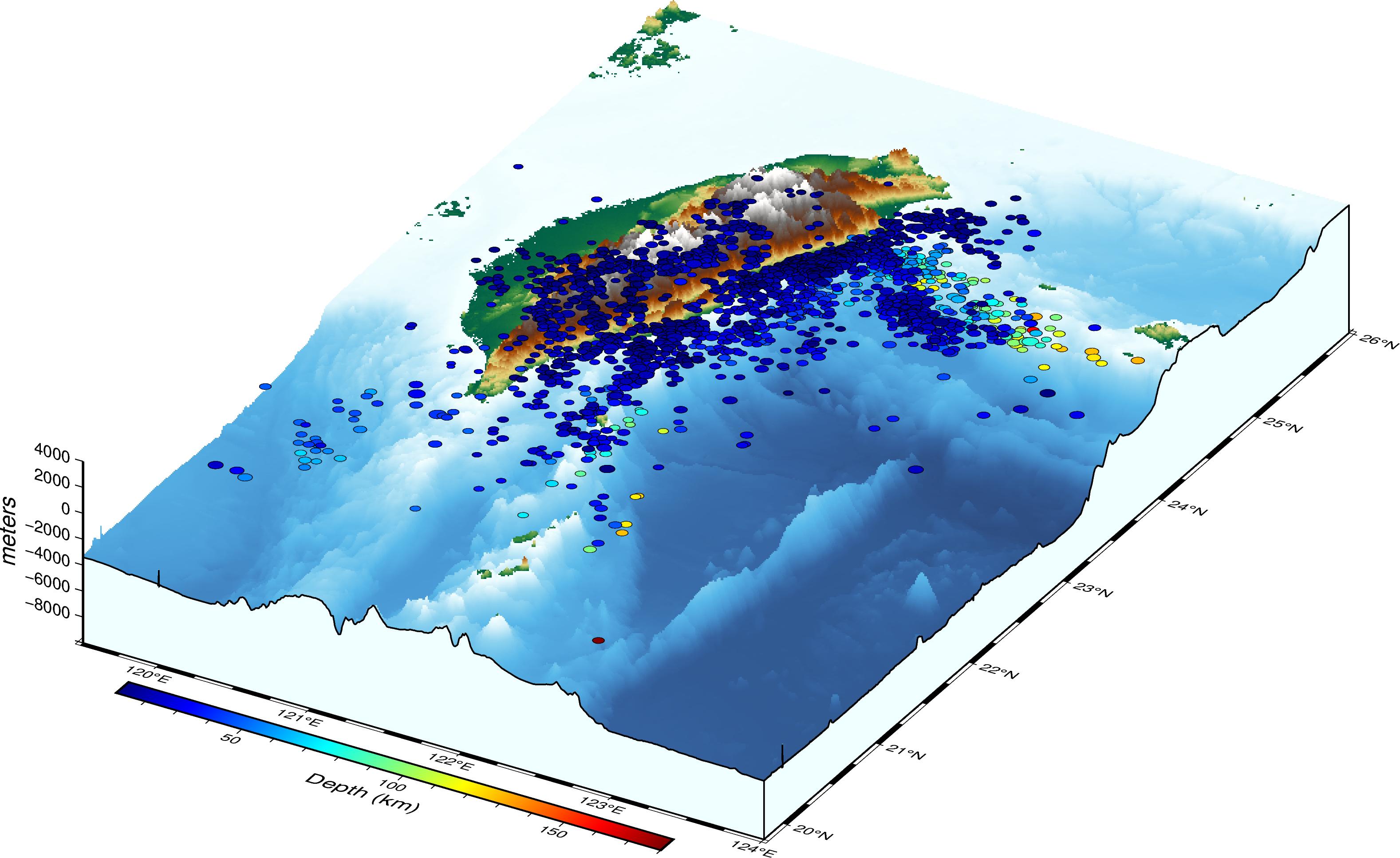
Read the earthquake data from a data file and overlay on a three-dimensional topographic map using PyGMT.
You will learn how to generate and set up an SSH key for github so that you don’t need to always type your username and password when accessing github repo.
We will see how to load shared libraries in C/C++. We will write a library to convert km to degrees and vice-versa. Then we create a utility program to conve...
We will see how to read a YAML file in Bash, C/C++ and Python.
Using multiple threads in C for concurrent process flow
We look into a quick overview of the idea of linked list data structure with some examples.
We will inspect the L-BFGS optimization method using one example and compare its performance with the gradient descent method
We will use the Python package to create beamer presentation and append existing figures to each slide
We will see how to plot a topographic map, overlay earthquake data on topographic maps, plot focal mechanism solutions and plot tomographic results on a geog...
While analyzing time series data, we often come across data that is non-uniformly sampled, i.e., they have non-equidistant time-steps. Infact, most of the re...
We will learn how to use the poetry package to create, manage, build and publish Python package on PyPI
Read the earthquake data from a data file and overlay on a three-dimensional topographic map using PyGMT.